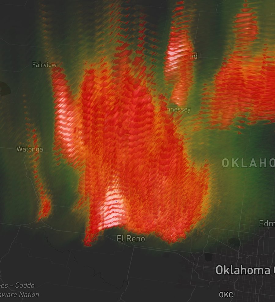
The 3D difference Pro
See the storm, not a slice
Most radar apps flatten a storm to a single tilt painted on a map. F5 Radar decodes every elevation cut and renders them as textured cones — or stacks the full scan into a volume you can orbit and tilt through. Mesocyclones, overshooting tops, and hail cores become something you can actually look at, not infer.
- Every elevation angle as a textured 3D cone
- Full volumetric render you can rotate and pitch
- Velocity couplets and echo tops in three dimensions
What else it does
Serious radar, all the way down
Live, coast to coast
Every US NEXRAD site, with a live edge that keeps building the newest volume radial by radial as the dish sweeps.
Decades of archive
Replay any storm from the public Level II archive, frame for frame and fully reproducible — from historic tornado outbreaks to landfalling hurricanes.
Storm science built in
Model soundings and hodographs, velocity dealiasing and storm-relative motion, and a live GOES-satellite lightning overlay.
The great storms, curated
Landfalling hurricanes, violent tornadoes, and derechos — each with the radar loop pinned to the right site and moment. One tap to the radar.
Warnings that find you
Save the places you care about and get NWS tornado and severe warnings pushed — filtered to exactly the alert types you choose.
Share the moment
Send a link to an exact radar moment. Anyone who taps it lands on the same loop, same frame — in the app, or here in the browser.
Products
The full dual-polarization suite
Pricing
Free to start, Pro when you want more
Free
No account, no catch
- Live 2D radar for every US NEXRAD site
- NWS tornado & severe-warning alerts
- A curated set of featured storms
- Share any radar moment as a link
Pro
Everything in Free, plus
- 3D & volumetric rendering, anywhere
- The full historic Level II archive — any date
- Storm library, compare & damage-survey tools
- Historic controls: shift, jump & swap radar sites